- Joined
- Mar 12, 2016
- Messages
- 3,920
- Reaction score
- 2,623
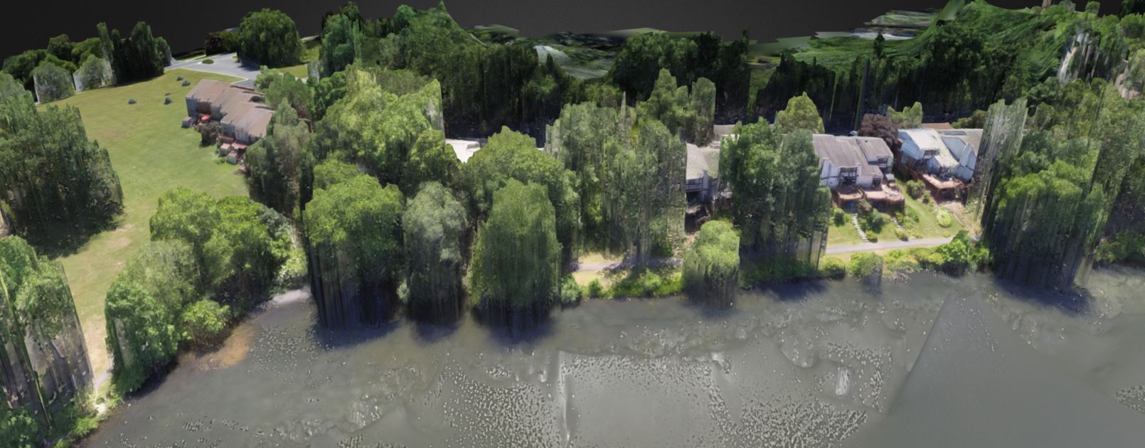
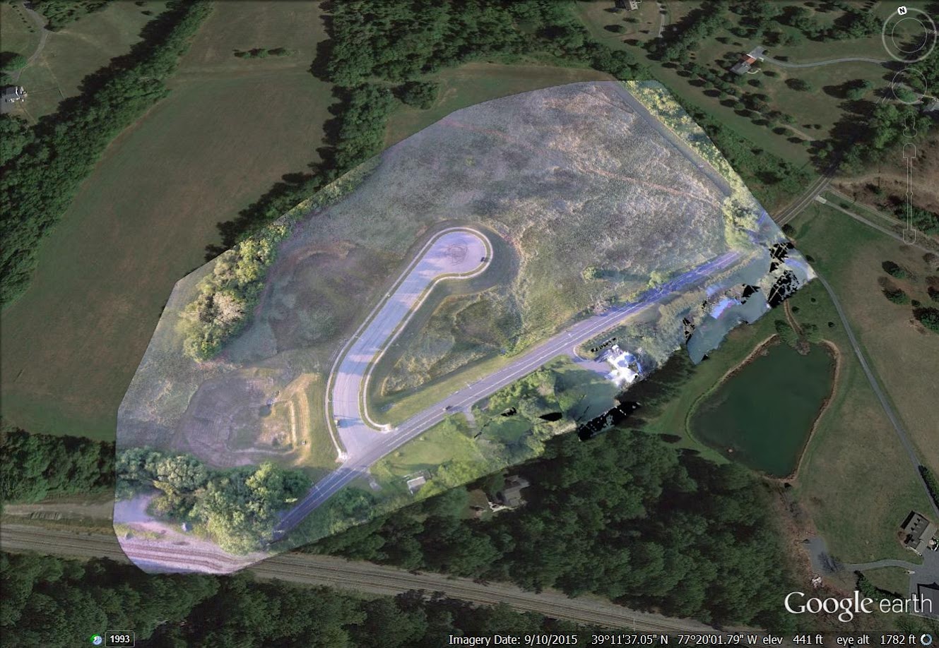
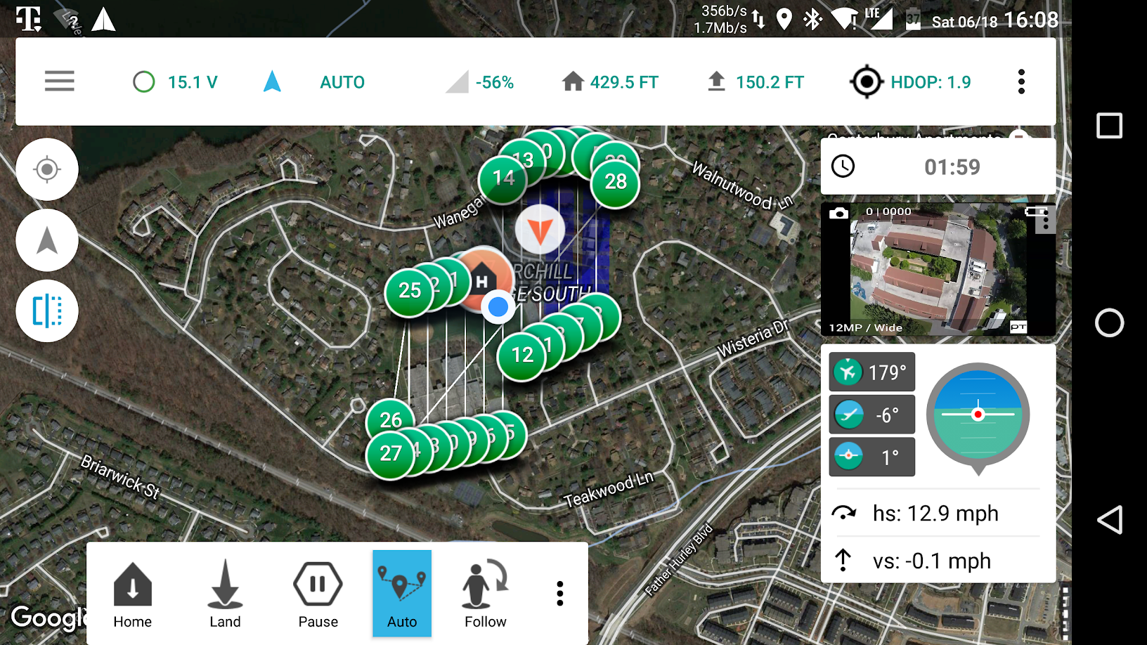
In all the years I've been tinkering with drones, I've never actually tried doing orthomosaic surveys. I've been single, bored, and it's beautiful out. So why not. This weekend, I did three. Two are done and pictured below. The third is processing and probably won't be done until later tonight. Man this stuff takes some CPU power! But it is so cool.
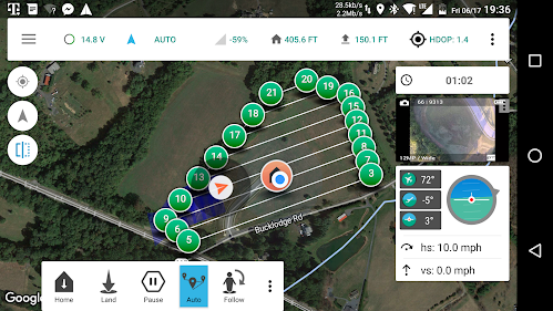
I used the Solo, GoPro 4B, and Tower. Georeferenced all the photos with Mission Planner. And used the Pix4D trial to the processing for the first two below. The third one processing now, I'm trying out Drone Deploy. For the third one, I also flew the grid twice, 90 degrees offset, with the camera at 10 degrees rather than straight down. Experimenting.
First one at a vacant lot on a useless empty road the county built. Flown at 150ft, 10mph, 70% overlap, 70% sidelap. This was painfully slow to watch for someone impatient like me, but it came out great. The dog supervised, and it was a nice night to sit on the deck while it processed.


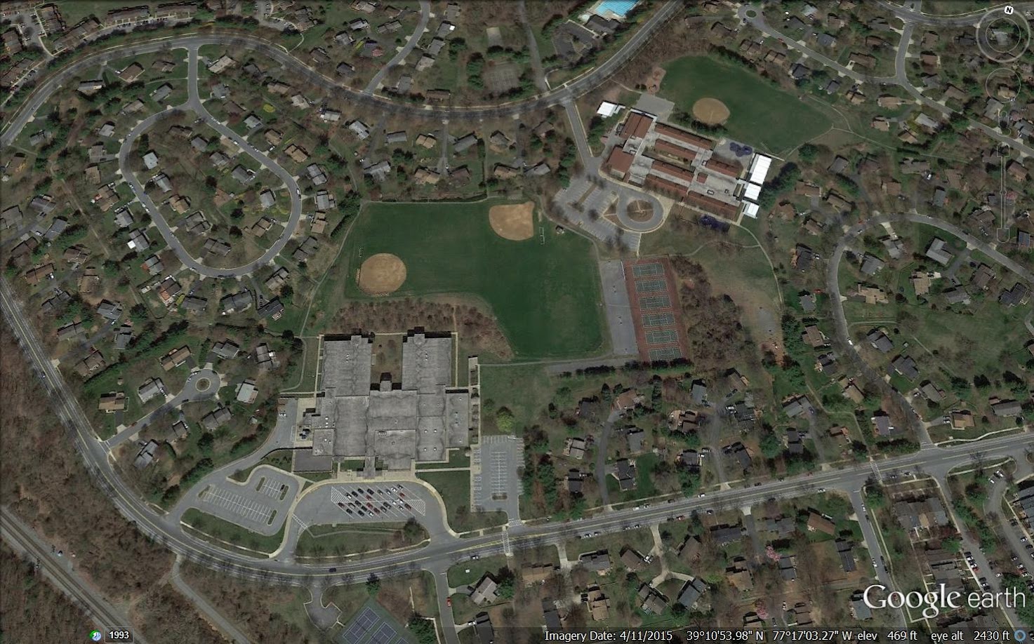
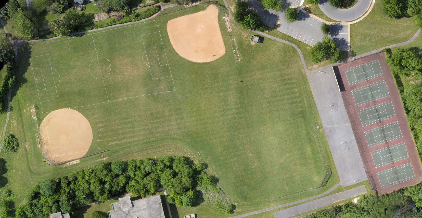
Second mission was two schools next to each other for a nice big area to fly. Also flown at 150ft, but this time at 15mph. I was worried that might be too fast, but it also came out great.

I used the Solo, GoPro 4B, and Tower. Georeferenced all the photos with Mission Planner. And used the Pix4D trial to the processing for the first two below. The third one processing now, I'm trying out Drone Deploy. For the third one, I also flew the grid twice, 90 degrees offset, with the camera at 10 degrees rather than straight down. Experimenting.
First one at a vacant lot on a useless empty road the county built. Flown at 150ft, 10mph, 70% overlap, 70% sidelap. This was painfully slow to watch for someone impatient like me, but it came out great. The dog supervised, and it was a nice night to sit on the deck while it processed.
Second mission was two schools next to each other for a nice big area to fly. Also flown at 150ft, but this time at 15mph. I was worried that might be too fast, but it also came out great.
Last edited: