Elongated structure scan

Joined
Aug 17, 2016
Messages
36
Reaction score
8
Age
58
Anybody have a suggestion for using Solo and Tower (or MP) to create point cloud of a series of utility poles? Something like Tower's Structure scan would work, except the the 'structure' is long and narrow, something like 30' x 200', so an orbit needs to be elliptical rather than round. Is there a way to do that? I need to be able to automate camera to manage 75% overlap.
 
Just to clarify my previous post, in teh image below the poles numbered 22-26 would be my structure, and the yellow line is the
5575-9aa83d228d686213f1a0768f577ec082.jpg
mission path I need.
 
Just to clarify my previous post, in teh image below the poles numbered 22-26 would be my structure, and the yellow line is the
5575-9aa83d228d686213f1a0768f577ec082.jpg
mission path I need.
In order to keep it automated, I believe the easiest would be to use the exact center point between the poles as the center of the 'structure' then expand it until you have just a safe clearance around each end. Then program the step between orbits to accomplish the desired # of orbits. Otherwise it would have to be a series of regular WPs with the increase in altitude, but not sure you could get the # of orbits needed placing WPs so close to each other.
 
use the exact center point between the poles as the center of the 'structure' then expand it until you have just a safe clearance around each end
This is problem I need to resolve. Some of the runs are quite long and would put the aircraft hundreds of feet out if I just run a circular scan. I need an ellipse.
 
This is problem I need to resolve. Some of the runs are quite long and would put the aircraft hundreds of feet out if I just run a circular scan. I need an ellipse.
Not sure what the desired end product is desired. Doing a scan of more than 1 tower with a long distance between them would be of little interest with so much un-needed data between them getting equal scanning.
 
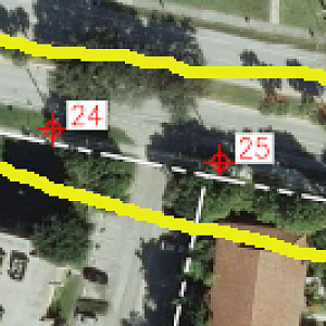
I understand you are trying to point towards the structures as you pass them. Keeping with how orbit works, nose in. However, pole 24 would end up being your ROI as it traveled even as flown elliptically

What you'd need to have is the copter follow a line, with the line being the ROI, for an auto mission like a Survey. Setting a distance parameter from the line. Anything can be done, but you'd need to program what you are asking to follow the line. The dev working on MP, Michael Oborne, could be contacted for such a feature request. I could see it as a useful tool and it would seem relatively easy logic setting up...just need to understand coding...

You could program a mission in MP/Tower to fly an odd rectangle and have it point 90/270 degrees of the flight path (yaw_angle I believe). Give that a try, if it works then it could be implemented into a mission as an auto task...
 
You could program a mission in MP/Tower to fly an odd rectangle and have it point 90/270 degrees of the flight path (yaw_angle I believe). Give that a try, if it works then it could be implemented into a mission as an auto task...
Thanks, Rich. I think that will work. Gonna run some testing tomorrow. Will have to do some calculation on triggering shutter to get good overlap.

I'll shoot a message to Michael Oborne about adding the feature.
 

Members online

No members online now.

Forum statistics

Threads
13,093
Messages
147,741
Members
16,048
Latest member
ihatethatihavetomakeanacc