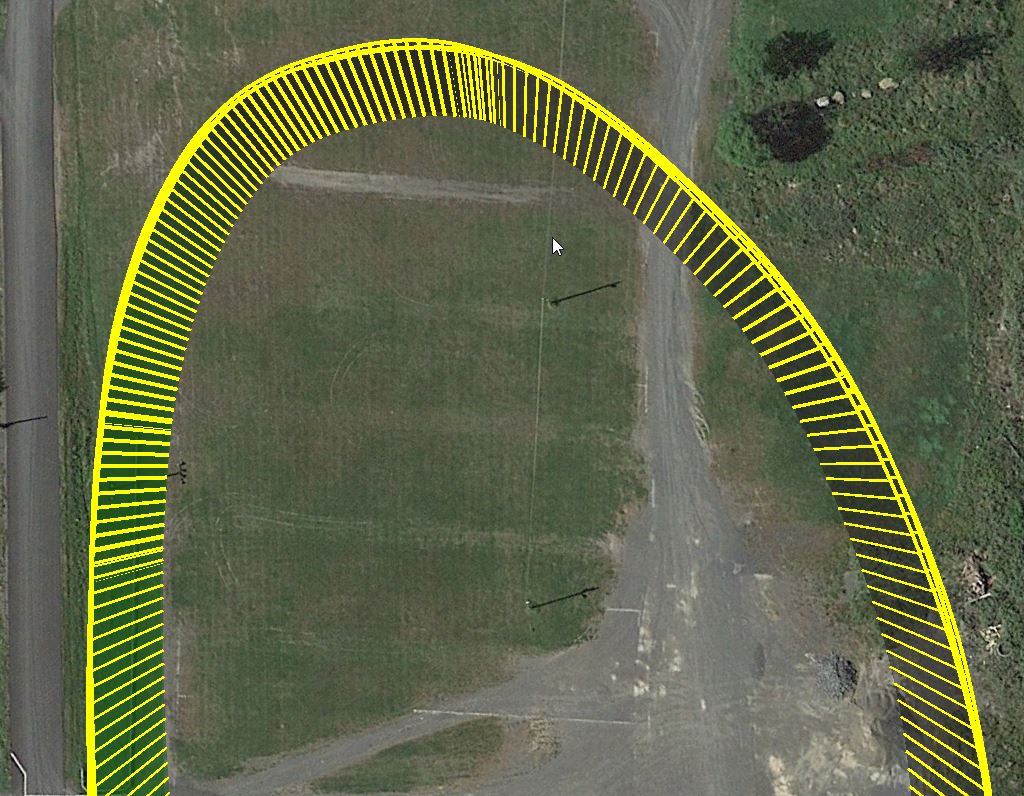
In Tower or MP, what's the best way to get smooth flight paths along random curves? I'm finding it difficult to impossible to replicate specific curves using spline waypoints. There's a small river I'd love to fly down, but there are random curves and straight sections that seem to thwart any attempt to lay a flight path right down the center.
At the same time, my flights using straight waypoints seem pretty smooth - the quad does a nice fly through the corners as opposed to stopping, rotating towards the next waypoint and continuing. I think in the flight controller's parameters I have a 5 foot radius set, so as long as the quad gets within 5 feet of the waypoint, it checks it off it's list and continues to the next.
So that makes me think it'd be better to use a bunch of normal waypoints than a few splines. I'm going to test this over the next few days, but I thought I'd ask if anyone else has run into this.

")