M8N GPS vs Pixhawk 2.0 Cube

Joined
Jul 12, 2016
Messages
11
Reaction score
1
Age
61
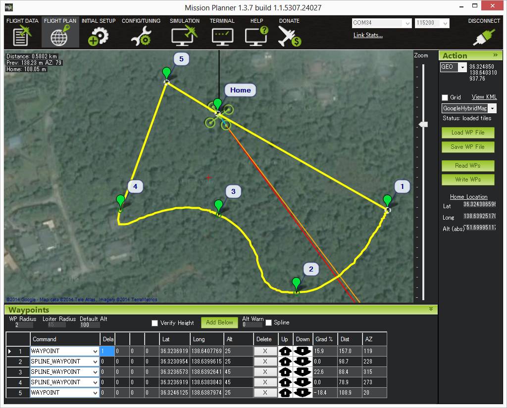
Set up a Cable Cam down the center of a descending road and my Solo promptly ran into a tree branch 5' from the set point. (Propeller guards were ineffective against the branches.) Are there ways to increase the accuracy?
Would the mRo GPS u-Blox Neo-M8N/ 3DR SOLO Upgrade (mRo GPS u-Blox Neo-M8N / 3DR SOLO Upgrade) increase the accuracy of the set points?
How about the 3DR Pixhawk 2.0 Cube (SOLO Replacement) (3DR Pixhawk 2.0 Cube (SOLO Replacement) What I find perplexing after reviewing 3drpilots.com as well as the Pixhawk 2 Facebook pages for a couple of nights now is whether this Pixhawk cube is an alternative that actually fits inside the off-the-shelf 3DR Solo. If so, where does it go? On the bottom of the largest board in the Solo below the battery compartment? Or is this cube for other custom products made from 3DR components? This cube appears to be too voluminous to fit in the space where the GPS board is located. Is this cube plug and play as the mRo GPS u-Blox Neo-M8N/ 3DR SOLO Upgrade appear to be? Is the GPS board redundant of the Pixhawk 2.0 Cube?
What's so off-putting is mRobotics.io comment on their 3DR Pixhawk 2.0 Cube page, "There is not much documentation/information available, so you are on your own."
Thank goodness for the 3DR Pilot community so we're not alone.
If such a Pixhawk cube can fit within the 3DR Solo, is it worth the 73% premium price to wait for the Pixhawk 2.1 "green" cube? (Green Cube for Solo (Late April Batch) - Pixhawk2). I don't intend to fly this in the cold, and I'm not going to disassemble it, so I don't see the benefit of the heater and the absence of glue. Are the sensors so superior that I won't run into that tree?
My Solo flew higher and further than the set point created just minutes before. I understand that the barometer senses the vertical position of the set points. Would either of these cubes (assuming they would fit in one of my off-the-shelf 3DR Solos) with their redundant barometers be more likely to return to the same set point?
Thanks again for clarifying something that must be terribly obvious to most of you who build your own drones from scratch.
Chris P.
 
A few things:

  • The Solo's Pixhawk two is under the main board. You can't see it without unscrewing the board and lifting it up. It is the same dimensions as the newer Pixhawk 2.1 and green cube.

  • No you cannot buy a plain old Pixhawk 2.1 cube and put it on the Solo. The Solo's PH2 is modified with different hardware, voltages, etc. And the Solo branch of Arducopter will not function on the plain old Pixhawk 2.1 either. The green cube is a Pixhawk 2.1 with the necessary hardware changes to be compatible with the Solo. So if you want to upgrade the Pixhawk, that's what you need.

  • Heated IMUs have nothing to do with cold outside temperatures. It's not a cold weather system. It is heating (or not heating) the IMUs to makes sure that each one is the same optimum temperature. The IMU hardware itself is also simply better, and there are more of them.

  • The pixhawk has nothing to do with your incident with the three branch though. So that shouldn't be a reason for or against upgrading. The Green Cube is experimental. It is not something you'd buy just for the hell of it, or because there is something wrong with the stock PIxhawk.

  • GPS of any kind is of lowest accuracy when at low altitude surrounded by obstructions. You were descending down a hill a low altitude below the tree line surrounded narrowly by trees 5ft away. I would be more surprised if you didn't hit a tree. The mRo GPS can perform better in these scenarios than the stock Solo GPS. But that doesn't mean the mRo or any other GPS will perform adequately enough in all cases in such scenarios. What you were doing was risky with any drone using any GPS.

  • MPCC uses splines to form the flight path. Where there are curves, the solo will swing a wide smooth turned passing through the point in the middle of the turn. As a general rule, you should have a 10ft radius bubble of clear air around a cable cam point to account for this. This applies to vertical curves too (changes in altitude). So in the narrow corridor of trees only a few feet away from the point, I again would be surprised if you didn't hit something.

  • Prop guards are useless junk.
 
Thank you Pedals2Paddles for the thoughtful reply.
I should not have expected my success in using set points at the beach would translate to the forest. I'll start with changing to the mRo GPS and finding a location where I can set a 10' bubble around the set points.
Why is there so much interest in upgrading Pixhawk? I mean, what are the benefits of the optimum temperature and higher voltage? Is it simply to make them more reliable? Which could certainly be a huge benefit when they are flying over people's heads or over water.
I find that the prop guards are helpful to avoid tip overs when landing on sand because the 2' x 3' mat that I've used for takeoffs is not sufficiently large when using the Return to Home (RTH) function. I usually have to manually adjust the landing to hit the mat. When I have missed, though, the prop guards have prevented the props from chopping into the sand. I thought that I'd get better with experience, but I need more practice.
 
The prop guards tend to be more of a drag and sail than protection device. If you're tipping over on landing a lot, I would work on landing techniques so you eventually won't need them anymore. The most reliable way to land is in manual mode and do it yourself. Especially if the surface is uneven or GPS may be dodgy.
 
I hadn't thought of how much the prop guards could act as a sail. Makes sense. Just ordered the mRo GPS board. I'll see how it works. Thanks again.
 
  • MPCC uses splines to form the flight path. Where there are curves, the solo will swing a wide smooth turned passing through the point in the middle of the turn. As a general rule, you should have a 10ft radius bubble of clear air around a cable cam point to account for this. This applies to vertical curves too (changes in altitude). So in the narrow corridor of trees only a few feet away from the point, I again would be surprised if you didn't hit something.
OK, 10' radius around a programed path.

1) ANY programmed route?
2) What can or can conceivably be done to narrow that failsafe buffer?
3) re: barometers- If there are two, which one decides what?
4) Is there a barometer that is more accurate than the one(s) in Solo?

mahalo (in Hawaii)
 
Folks want to replace the Pixhawk simply because we like to tinker. The stock Solo Pixhawk 2 is a fine unit for what it is expected to do.
The GPS is another story. I strongly encourage you to do the upgrade to the MRo unit. As P2P mentioned it won't give you centimeter accuracy, but with 20+ satellites you get a much more robust solution.
As you mentioned the altitude is measured by a barometer inside the Pixhawk. It does a pretty darn good job in a hover but during forward flight you will see some inaccuracies of up to a couple feet.
If you have the need for extreme position accuracy, then look into getting an RTK system. I don't believe there is a plug and play solution yet on the market for Solo.


Sent from my iPhone using Tapatalk
 
  • Like
Reactions: Mauiwind
The 10ft radius around points in the cable cam smart shot points accounts for reasonable GPS position error, reasonable changes in barometric pressure, reasonable barometric altitude variations from wind pressure, and the spline curvature flight path that a cable cam uses around those points. These are not really factors you can eliminate. It's the nature of GPS, air pressure, and spline turns.

The same applies to waypoint missions you create in Tower or Mission Planner btw.

This illustrates a spline curve through a waypoint and how it may curve wider than expected to smooth the curve and movement. Because math.

MissionList_SplineWaypoint.jpg
 
  • Like
Reactions: Mauiwind
Mahalo Pedals,

As relating to barometric pressure sensors and accuracy over:
land or
water?
Do baro sensors have issues over water relative to ground (land)?
1) I never did get an answer about dual pressure sensors and how they decide which one is true or dominant.

2) As barometers can be calibrated to respond to various atmospheric pressures, does it (would or could) it make a difference for the accuracy of a boro sensor on a Solo?

3) What atmospheric conditions effect sensor readings?
How does wind affect a reading?
How does prop ground effect affect a baro reading?
If they affect readings? Which way is Solo going to react?​
 
  • Barometric altitude will not have any difference over land vs water.
  • The two baros read the same. They're for the purpose of cross checking each other for errors.
  • No calibration needed. They're not measuring a calibrated altitude above mean sea level like a manned aircraft altimeter. It's measure the difference between the pressure when it was armed for takeoff on the ground vs current pressure. The pressure increase or decrease with altitude is constant. So it's measuring, in essence, height above ground.
  • If a heavy wind pushed into the body of the solo, such prop wash while just above ground, it can cause a false reading of a pressure increase. Increasing pressure generally indicates descending altitude, so it would indicate a false descent. The solo would respond by increasing power to climb or stop the descent that isn't actually happening. But this is mostly compensated. The pixhawk favors the IMUs more than the barometer when very close to the ground in order to avoid this.
 
By spline, do you mean the yellow colored path in the image below that deviates from the red colored vectors between each set point? In the case of the purple vectors between set points 4, 5, and 1 (purple arrows) the actual path (yellow path) could be quite precise, but between points 1, 2, 3, and 4 the "splines" cause the aircraft to deviate from the red colored vectors to the yellow path?
 

Attachments

  • MissionList_SplineWaypointRoute.jpg
    MissionList_SplineWaypointRoute.jpg
    68.1 KB · Views: 26
Yes. That is also just an estimate of what Mission Planner thinks it will be. Actual flight path may vary a bit.
 
  • Like
Reactions: ChrisP3
If you have the need for extreme position accuracy, then look into getting an RTK system. I don't believe there is a plug and play solution yet on the market for Solo.

Drotek in France does have a P&P (as far as installation and fitment) RTK board. Pricey and of course needs the RTK ancillary pieces like a base station.
 
  • Like
Reactions: andrew.baker.142
Drotek in France does have a P&P (as far as installation and fitment) RTK board. Pricey and of course needs the RTK ancillary pieces like a base station.
Thanks, RickP.

So for the Drotek Real Time Kinematics system, the Solo would need their $306 M8P GPS board, 3DR SOLO RTK GPS (NEO-M8P), and a base station in proximity such as the $371 tiny RTK with an antenna, Tiny RTK GPS based on u-blox NEO-M8P ? I realize that there is also a need for a power source for the base station.

Would you also need the $371 Rover board on the Solo, Tiny RTK GPS based on u-blox NEO-M8P, or is that the function of the M8P GPS board? In other words, is this a $677 solution or a $983 solution?

I have no experience with RTK. Drotek has a forum that you can post these types of questions. You will need the Solo board which is essentially cast in a rover role. Also the base station and telemetry function to communicate between the base and rover. It's not really clear from the Solo board description how that telemetry function is provided on the Solo but I suspect there are other parts required. Again, the Drotek forum should be a starting point.
 
  • Like
Reactions: ChrisP3
Just to make sure there isn't some confusion here... throwing RTK equipment at the solo is not going to avoid the situations that led to this incident.
 
This thread could offer some additional insight to waypoint settings, whether Tower, Mission Planner or a MPCC.

Sharper corners in MPCC

Want to add a caution, speed will effect further how the waypoints are met and navigated, splined or otherwise. For both horizontal and vertical motion. Change the time to fly in a MPCC and you see the variance of the flight path.

Nice explanation throughout this thread @Pedals2Paddles, covers a lot of ground with good details.
 
  • Like
Reactions: ChrisP3
Since the mRON gps u-blox is out of stock will this be a good alternative ? Amazon.com: Welcomeuni Ublox NEO-M8N BN-800 GPS Module Support GPS GLONASS BeiDou For Pixhawk APM: Toys & Games

Thanks
Vic
The mRo GPS u-Blox Neo-M8N/ 3DR SOLO Upgrade (mRo GPS u-Blox Neo-M8N / 3DR SOLO Upgrade) is currently in stock. I recall checking several weeks ago and they were not in stock. I ordered one last night. At the moment there are 71 left in stock. Thank you mrreddog for the reference to the drotek version of a similar board.
 

New Posts

Members online

No members online now.

Forum statistics

Threads
13,094
Messages
147,748
Members
16,057
Latest member
Motoxxx1986