


Hello,
Could someone tell me if there is anything wrong with these photos or with the flight log?
The P3 pro was used to fly and the camera Mapir survey 3N OCN. The flight was made at altitude of 60 m, with 80/80 overlap, speed of 6m/s, image capture every 2 seconds.
I tried to generate the orthomosaic in the agisoft following the guides available in the site of mapir, however the photos do not align and the mosaic is not generated.
Whats is wrong?
Thanks.
*the photos I send are straight from the camera, not processed in MCC. I also have more photos and the RAW if you need it.
Attachments
-
Logs_voo_23.03.19.zip4 MB · Views: 0
-
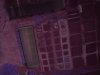 2019_0323_105044_040.JPG3.5 MB · Views: 16
 -
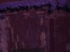 2019_0323_105047_042.JPG3.5 MB · Views: 16
 -
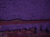 2019_0323_105052_044.JPG3.8 MB · Views: 13
 -
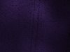
 2019_0323_105055_046.JPG3.6 MB · Views: 14
 -
 2019_0323_105100_048.JPG3.6 MB · Views: 13
 -
 2019_0323_105103_050.JPG3.6 MB · Views: 11
 -
 2019_0323_105108_052.JPG3.8 MB · Views: 11
 -
 2019_0323_105111_054.JPG3.6 MB · Views: 11
 -
log.zip1 MB · Views: 1